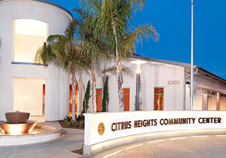
Citrus Heights
 Citrus Heights, a suburb of the capital of California, has been a leading agricultural and transportation center for most of its history. In the past 15 years, as costs have escalated in California’s coastal cities, thousands have migrated to the area for its reduced cost of living and proximity to San Francisco and Lake Tahoe. Now, as a result, growth and traffic issues have become top-of-mind issues for the area. Citrus Heights is pleasant and attractive but somewhat lacking in entertainment and activities (aside from restored historic “Old Sacramento” riverfront downtown area). Most recent growth has occurred to the north, northeast, and south as typical California sprawl- freeways, strip malls, and endless developments of tightly packed homes. Job growth projections remain strong.
The Citrus Heights area has a broad variety of recreational opportunities including water and mountain sports. Excellent skiing and many other recreational opportunities are a moderate day trip away. Professional sports teams, such as the NBA Kings, add to recreation and the overall economy, and the arts and culture scene is on the upswing.
The climate through most of the year is an advantage, although summers can be uncomfortably hot. The Cost of Living Index is high for what’s available and is increasing. While growth is an issue, the area is more family friendly than most California cities and does have several attractive family neighborhoods (particularly along the US 50 corridor).
Lincoln, formerly a sleepy agricultural town to the northeast, has become a booming family and retirement center, and home to one of the two large Del Webb “Sun City” active senior complexes. Roseville is an overbuilt suburban town and hub to the rapidly growing northeastern suburbs in southwestern Placer County, while Arden-Arcade is an older inner suburb and commercial area a few miles east of downtown. The metro area now also includes Yolo County, site of the excellent college town of Davis and the growing small residential towns of Woodland and Dixon.
At Citrus Heights, located along the banks of the Sacramento River, the Central Valley is approximately 50 miles wide. The terrain is completely flat. A few miles to the east, rolling terrain rises gradually to the 8,000-foot to 10,000-foot Sierra Nevada crest. Local natural vegetation is grassland; deciduous trees have been planted in the inhabited area. The Mediterranean Central Valley climate is mild with abundant sunshine most of the year. Summer is dry with warm to hot afternoons and mostly mild nights. “Delta breezes” from the Bay Area cool the region. Most rain falls from November through March. Heavy snowfall and torrential winter rains fall on the western Sierra slopes and may produce flood conditions along the Citrus Heights River and its tributaries. Winter brings sometimes heavy and persistent ground fog.
Population Data
| City Population | 86,145 |
| Urban Area Population | 1,393 Million |
| Metro Area Population | 2.176 Million |
Demographics
| Race | White 82.8% | Other 6.4% |
| Hispanic Origin | 16.9 % |
| U.S. Citizen | 92.9% |
Education
| College Degree or Higher | 30.2% |
| High School Diploma | 26.7% |
| Less Than High School | 10.1% |
Income Data
| Median Household Income | $54,236 |
| Per Capita Income | $25,725 |
| Below Poverty Line | 12.8% |
Economic Data
| Median Home Price | $239,500 |
| Unemployment Rate | 5.9% |
| Sales Tax Rate | 8% |
Boundary Maps

